 Metropole NCA
An ancient salt trading route, the Pagarine Route is a new 159km walking path from the French Riviera up into the Italian hills that’s now welcoming hikers.
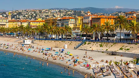
I was standing on the lively Plage des Ponchettes beach at the eastern end of Nice’s Promenade des Anglais, the large pebbles massaging my feet as I inhaled the salty whiff in the air and watched the early-morning swimmers hobble over the stones to the sea. The hum of traffic on the coastal road was broken momentarily by the squawk of a gull as it launched itself from the shore into the blue sky, narrowly missing a small group of runners.
It was busy that day, but Nice’s city beach has been full of activity for hundreds of years. The city was an important hub for the salt trade in the Middle Ages and the salt was brought ashore on Plage des Ponchettes in small wooden row boats before being taxed in nearby Cours Saleya, Nice’s centuries-old marketplace, and taken by mule on a gruelling journey to Italy where it was traded for use in the mountains and further north.
Today, Plage des Ponchettes is the starting point for the Pagarine Route, a new 159km hiking path between Nice and the Italian city of Cuneo that traces the steps of these medieval salt traders.
As sustainable tourism officer for Nice Côte d’Azur, Sophie Spillaiert has been working on this EU-funded, cross-border sustainable tourism project since 2019. “There was a lot of salt production near here and it was all brought to Nice to be unloaded on the beach and then packaged, weighed and taxed in Cours Saleya,” she explained. “The building on the corner, which is now the Centre du Patrimoine, was where the traders had to pay the salt tax – or the gabelle as it was called – before they were allowed to leave town on the way to the border regions.”
 Getty Images
Salt routes have existed for centuries, linking coastal cities to inland areas and enabling a flow of goods and people in both directions. Nice was already a prosperous trading port in Roman times and being the hub of the salt trade, particularly in the 16th and 17th Centuries, helped the city to become even more powerful and wealthy.
Hiking the Pagarine Route
The best way to complete the 10 stages of the Pagarine Route is to download the Outdoor Active app and search for “Les Routes du Sel: La Route Pagarine'” Here, the full route is described with turn-by-turn directions, points of interest and suggestions for accommodation and restaurants.
It wasn’t just Nice that felt the benefit of the money brought in by the salt route – towns and villages offered inns and refuges to weary merchants, while feudal lords shared in the tax wealth and built fortifications and employed men to keep the roads safe from bandits.
The Pagarine Route officially opened in autumn 2023 after clearing and cleaning the paths, but walkers and tourists have only really started hiking it this summer. In fact, the route is the newest of three salt routes (Les Routes du Sel) in this area that have opened as point-to-point hiking trails. The others are the Royal Route, which starts at Menton and also ends in Cuneo; and the Smugglers’ Route, which goes from Imperia on the Italian coast to the Piedmont town of Mondovi. I’d chosen to hike part of the new Pagarine Route since, in my view, it offers the richest story, taking you from an ancient square in the middle of the city where the salt started its on-land journey, up through lush landscapes and harsh mountain passes and over the border into Italy where it was traded
It is no wonder that there were so many routes, as salt was incredibly important in the Middle Ages. According to Sylvain Rouah, a guide at the Musée des Merveilles in Tende, a small town about 70km north of Nice that flourished in the Middle Ages due to its position on one of the salt routes, “It’s been called the ‘Medieval Petrol’ because they needed it in everything. And even before the Middle Ages, in the 11th Century, we can see its worth through words like ‘salary’ and ‘soldier’, which came about because Roman soldiers were paid with salt.”
 Getty Images
Spilliaert’s colleague Marion Polack agrees. “It was important for preparing the animal skins, preserving the food and acting as a medicine. But it wasn’t just salt that was being traded on these routes. They would buy local delicacies like chestnuts, cheese and wine from the mountains, paper from Cuneo, rice from Saluzzo and fabrics from Piedmont to take back and sell in Nice.”
The first part of the 10-stage route, the section I was hiking that day, is a 15.8km ascent from the coast into the hills behind Nice. The sun was already fierce at 09:00 as I threaded my way through the bustling, narrow streets of Vieux Nice.
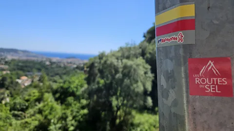
After a stop for a coffee outside a shaded cafe, I left the city centre behind and headed uphill. The jasmine-scented avenues in the city’s Cimez district and its Belle Epoque mansions were a throwback to 18th-Century opulence – Queen Victoria spent three winters here – and the route through the streets was easy to follow thanks to the red Les Routes du Sel stickers stuck to bus stops and signposts.
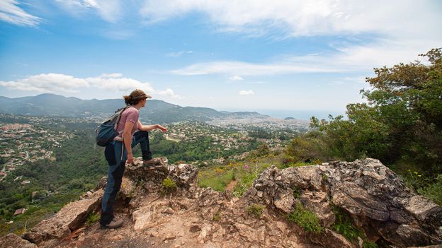
After a stretch of busy highway, I joined the pedestrian-only Canal Gairaut that weaves around Nice’s highest fringes. The views were breathtaking, taking in the city, the coast and that rich blue sea stretching to the horizon – it was the perfect place to stop and gather my breath.
The route was peaceful that day, full of bird song and plants, but life as a salt trader in the Middle Ages was hard and hazardous. The muleteers, their beasts and their carriages travelled in large groups to protect themselves from the dangers of the landscape, the weather and the ever-present risk of highwaymen. It is estimated that 60,000 to 70,000 mules walked the three salt routes each year at the height of the salt trade.
 Sophie Spilliaert
Turning my back on Nice for the last time, I made my way up to the top of the hill. Here, a scrubland path led to the small hilltop town of Aspremont, its looming gothic church marking the end of the 15.8km, 700m-elevation first stage.
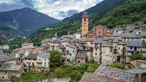
Each section of the Pagarine Route is different, varying between 10 and 20km in length, and 350m to 1,500m in elevation. You can choose to walk the whole thing or pick a single stage to tackle. The second stage climbs to Mont Cima at an altitude of 878m on dirt and gravel paths before falling and rising to another medieval village perché (hilltop village). This time, it’s Levens, known for its intact medieval houses and door lintels, and famed for its hundreds of thousands of cailletiers (olive trees) and the oil produced in its surrounding mills.
There are innumerable reminders of the salt trade on the hike, such as the ancient Cros d’Utelle bridge on stage three, which is thought to have been built by the Pagarine Route’s eponymous creator, a 14th-Century entrepreneur named Paganino Dal Pozzo who also instigated the gabelle tax system. You can see the remains of gabelle offices at strategic points on the roads in some towns and many of the narrow alleys through the old towns have shallow cobbled steps, which helped the mules to make their way up without slipping.
As the 10-stage hike approaches its middle section, the terrain and elevation get tougher. But the rewards are numerous – for instance, the picturesque town of Saint-Martin-Vésubie that provides overnight shelter on night five is nicknamed La Suisse Nicoise (The Swiss Nice) owing to its lush landscape, forests and lakes. It is the last stop before the route takes you through the Col de Fenestre mountain pass at 2,000m and you cross the border into Italy.
The Pagarine Route ends at Cuneo, a busy medieval town at the confluence of the Gesso and Stura valleys, whose 17th-Century cathedral demonstrates its historical importance as a salt trading point. It is also the home of the famous Cuneesi al Rum chocolate-covered meringue – a welcome treat for all walkers, and a little extra motivation for me to return and complete the full 159km hike.
Slowcomotion is a BBC Travel series that celebrates slow, self-propelled travel and invites readers to get outside and reconnect with the world in a safe and sustainable way.

