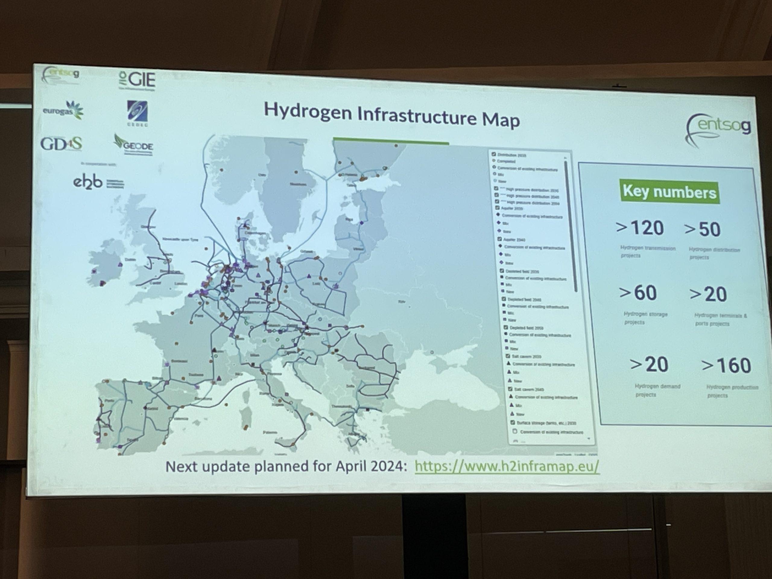
At Go Hydrogen, the focus was on hydrogen transport infrastructure. And the event provided an opportunity to present an initiative aimed at identifying pipeline projects in Europe through an interactive map.
Hydrogen Infrastructure Map is a shared initiative between a number of organisations, including ENTSOG (European Network of Transmission System Operators for Gas), GIE (Gas Infrastructure Europe), EUROGAS, CEDEC (European Federation of Local and Regional Energy Companies), GD4S (Gas Distribution for Sustainability) and GEODE (a consortium of gas and electricity operators). This work, in cooperation with the European Hydrogen Backbone, enables data to be compiled and presented to decision-makers and to the public.
The map shows projects scheduled for 2030, 2040 and 2050. To date, the database comprises 160 production projects, 120 for transmission, 60 for storage, 50 for distribution, 20 projects from hydrogen customers and 20 more related to ports and terminals.
The map can be zoomed in to show the connections between the various players and the types of pipelines being developed (pipeline conversions or new pipelines). Project developers are also encouraged to contribute to the map by filling out a form. It is a sort of Google Maps of future hydrogen networks.
Don’t miss out any hydrogen-related news or up-coming events and sign up to our newsletters:
Hydrogen news live (to receive our articles as soon as they are published)
Weekly newsletter (sent every Monday morning)
You can also follow us on LinkedIn for regular content and updates!
Article written by Laurent Meillaud and translated by Mariem Ben Tili

