

With low pressure over the UK on Tuesday 9th there is a risk of thunderstorms for parts of England and Wales. There has been a lot of cloud cover wrapped around this low but where gaps appeared, allowing sunshine, temperatures leapt up to 21C for north Wales, Merseyside, Manchester and Cheshire. A few lightning strikes appeared before 5pm.
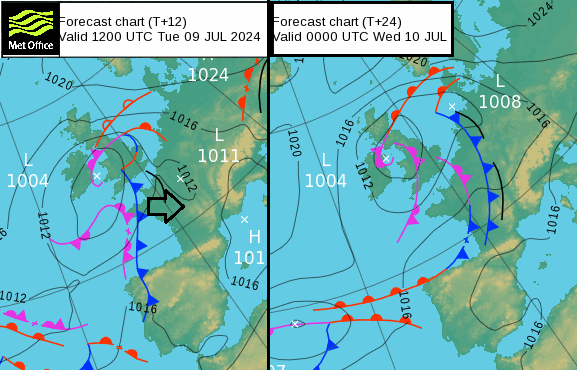
The setup over the UK on Tuesday includes a frontal band moving north, bringing a wet day for a central swathe of Britain and for Northern Ireland. As this moves further north tonight are is a warning for heavy rain and flooding over northern Scotland into Wednesday. Behind this front,
“a relatively warmer and more humid airmass. Where cloud breaks in the warm & moist airmass spreading north across England and Wales, surface heating in sunny spells combined with cooling aloft with approach of upper trough will create sufficiently steep lapse rates to support the development of heavy showers and thunderstorms.”
“…with breeze convergence may trigger heavy showers and a few thunderstorms.” Convective Forecast “There is a risk of E Sussex and E Kent being clipped by storms tracking NNE out of N France”
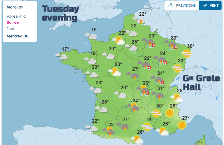
There is also a risk today over SE Britain with thunderstorms already breaking out on Tuesday afternoon over NE France. There has been heat today with temperatures in the high 20sC/low 30s and a cold front will add to the unstable setup overnight. There are various warnings for storms on Tuesday into Wednesday for France and the Benelux countries, with orange warnings for the Netherlands and Belgium warnings today.
https://x.com/HetweerinBelgie/status/1810687956400660734
These highlight the risk of lightning, large hail, high gusts and heavy rain including the risk of flash flooding.
Heavy thundery showers are edging from northern France into Belgium at 4pm BST. The risk of high gusts continues and a slight risk of tornadoes in this event. Severe thunderstorms are expected with heavy downpours, hail and flooding impacts.
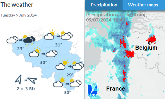
Also beginning to see heavy thundery downpours and strong wind gusts. The main band is forecast to move northeastwards, so missing eastern Belgium.
RMI ‘Heavy thunderstorms are expected in the province. Intense rainfall, hail storms, heavy gusts of wind or lightning strikes can cause widespread troubles or damages.’
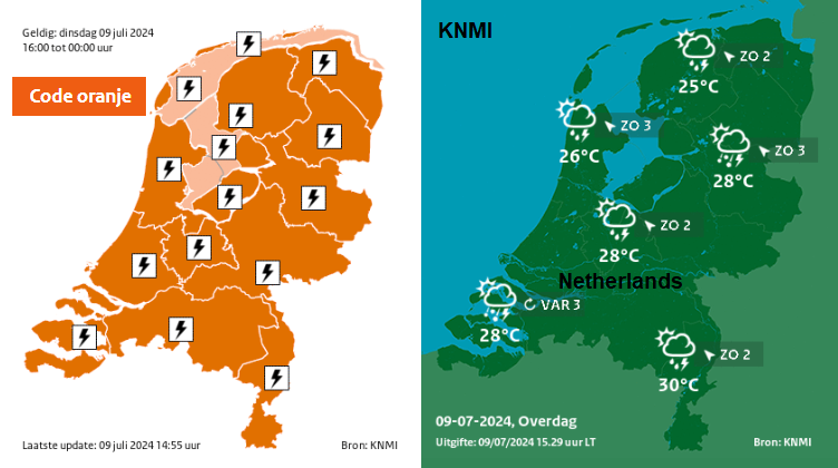
KNMI ‘From the end of the afternoon in the southwest and this evening in the rest of the country there is a chance of heavy thunderstorms moving from the southwest to the northeast over the country. These showers may cause heavy gusts of wind and locally a lot of rain, lots of thunder and large hail.’
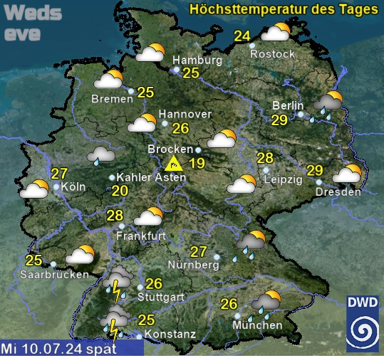
In Germany, Tuesday’s Euro 2024 football match will be away from the Thunderstorm risk, in the south in Munich. On Wednesday as England play the Netherlands in the second semi-final match at Dortmund, the weather should be fine and slightly fresher after a very warm Tuesday.
If you are heading abroad, for business or pleasure a quick look at Meteo Alarm can give an overview of the severe weather forecast across Europe.
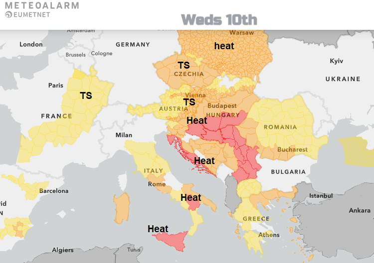
As northwestern areas stay soggy with wet and blustery weather, the heat continues in southeastern Europe.