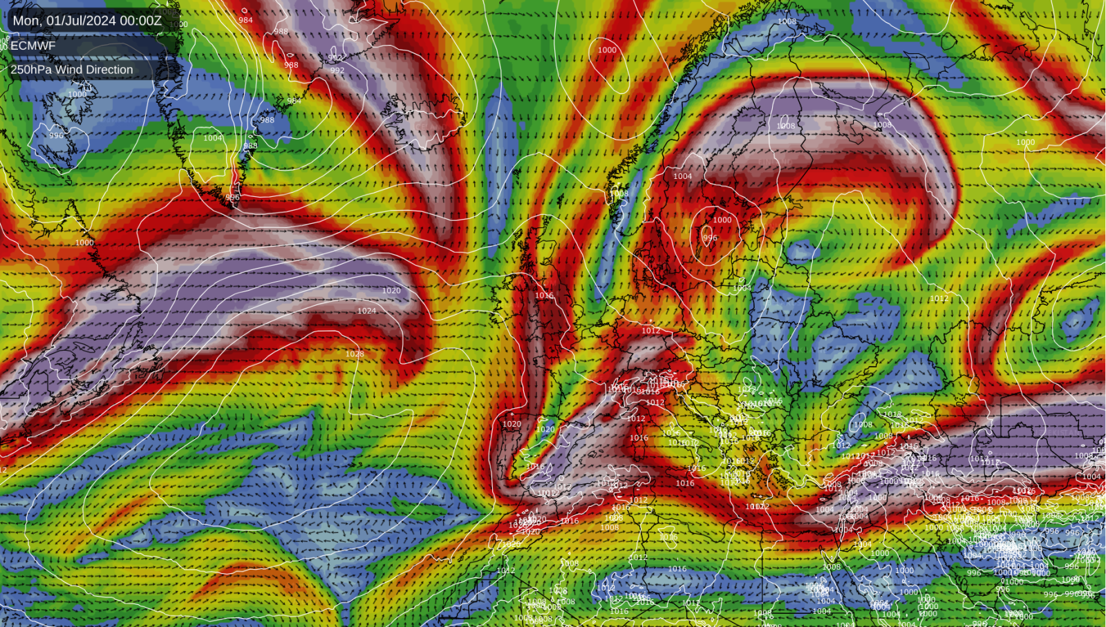
Although southern and eastern Europe can expect some more hot weather during the coming fortnight, it looks unlikely that it will turn hot in north-western Europe for a while. This is because we will have a strong high pressure area over the Azores and a strong jet stream running on its northern flank, bringing persistent west to north-westerly winds and some bands of cloud and rain coming in off the North Atlantic. It doesn’t look likely to be especially wet (unlike July 2023), but it will often be rather cool and cloudy.
As a result, it appears that Britain’s hot spell in late June 2024 was a one-off and, while it was associated with a pattern shift, we have shifted from one cool weather pattern to another. There are signs that temperatures may rise a little again once we get past the first week of July, but only to slightly above the seasonal average, with no heatwaves imminent. For much of Britain, particularly the west, the first week of July is looking rather cool due to winds blowing off a north-eastern Atlantic with sea surface temperatures close to long-term norms. These cooler temperatures, compared to last July, contribute to the forecast of limited rainfall.
For Britain, this weekend is looking set to provide a mixed bag of weather, with many areas being rather cloudy, although Saturday will have some sunshine mixed with showers in Scotland and some sunshine towards the south-east. Sunday is looking rather cloudy but with some sunny intervals and a scattering of showers, most of the showers in eastern counties. While next week is expected to continue this trend of cooler temperatures and overcast skies, there is potential for wet weather in the north, particularly western Scotland, towards the end of the week. This wet weather may extend further south by the weekend (6-7 July), with Sunday being the day to watch for those planning outdoor activities.
June so far
Overall, the recent hot weather has largely wiped out the cool first two-thirds of June. For the UK and for Central England, it is looking probable that June will come out cooler than the 1991-2020 long-term average, but by less than a degree, and roughly equal to the old 1961-1990 average, which was more representative of typical conditions during the 20th century. This highlights how difficult it currently is to get a substantially colder than average summer month, even relative to the most recent 30-year average ending in “0” (1991-2020).
June 2024’s mean temperature in Central England is set to be remarkably close to that of May 2024, a rare occurrence. In the long-running Central England Temperature series from 1659, May has been warmer than June only twice – in 1749 and 1833. While this year may not quite match that record, with May’s mean temperature of 14.1C likely to be just slightly below June’s, the proximity of the two months’ temperatures remains exceptionally uncommon. (Note that the mean temperature is the average of the maximum and minimum temperature – the mean daytime maximum temperature has been between 18 and 19C).
Unlike most recent months, June 2024 has not been particularly wet in most parts of the UK, and some regions are set to have quite a dry month overall. That said, for most regions it hasn’t been particularly sunny, with sunshine generally running near or rather below average.
Potential for a large “heat dome” in the western USA in 8 to 10 days’ time
Meanwhile, heatwaves are set to remain an issue in the United States, especially in the south, during the coming week. The most anomalously hot weather will tend to shift eastwards through the southern USA and Mexico, which have already experienced some exceptional heat so far this summer. The north-eastern USA is also currently hotter than usual for the time of year, but the heat in this region will subside during the next two days.
Both the GFS and ECMWF medium-range forecast models show high confidence in a large “heat dome” developing over the western USA in about 8 to 10 days, potentially extending into the northwest. While this forecast is still subject to change, the unusual degree of model agreement at this range suggests a substantial chance of another major heatwave affecting the region by around 8 July.

